AlphaIndies Logo AlphaIndies
Mission

AlphaIndies
Technology Vision

We believe technology works best. Modern innovation for the Agriculture and Industries.

We Are The Future

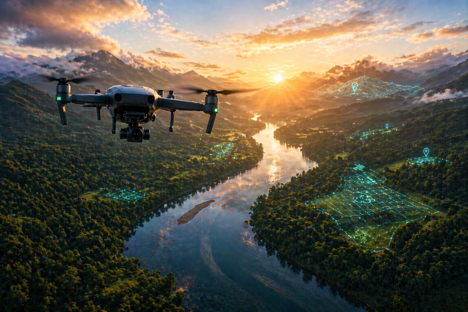
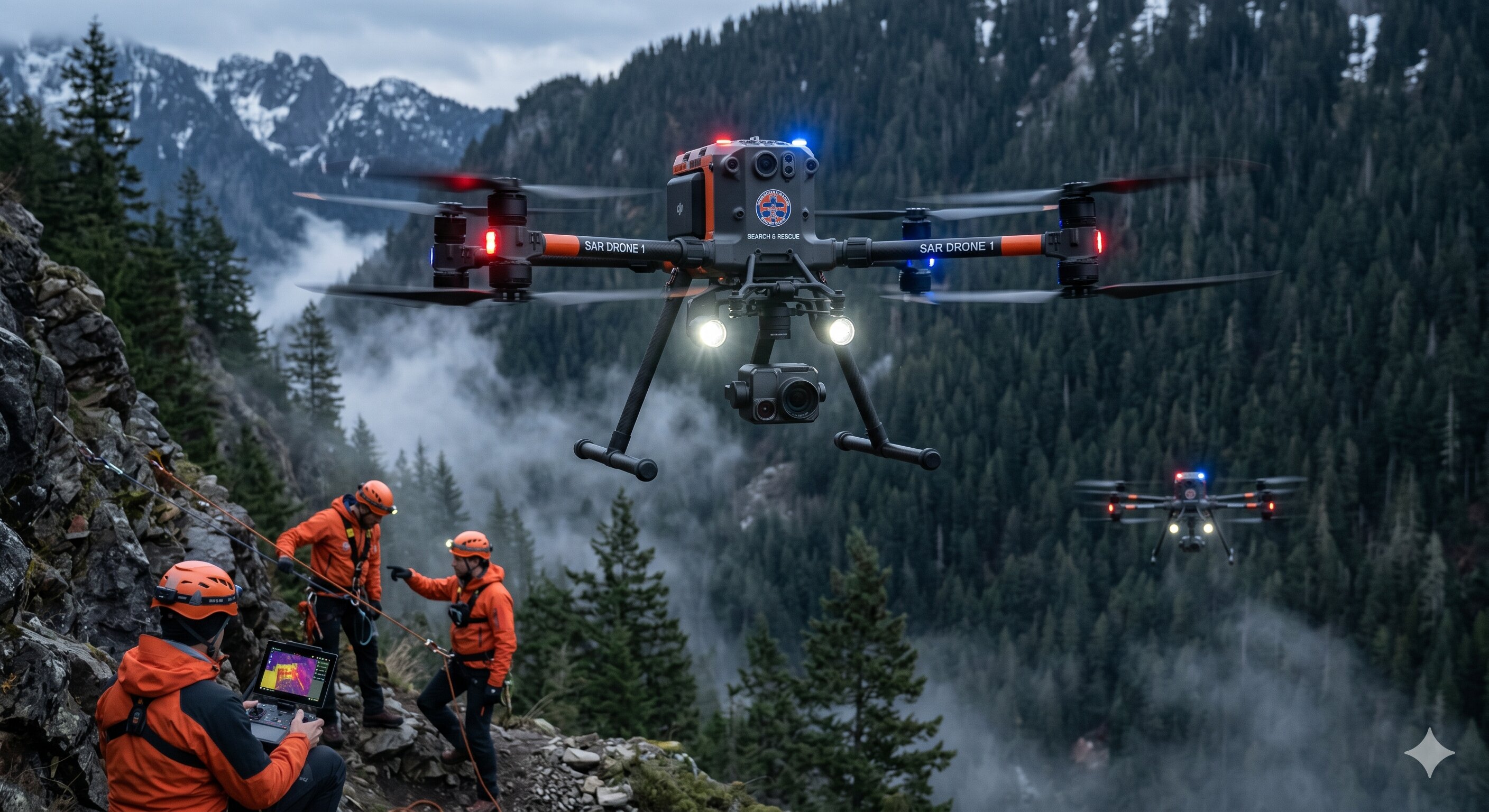
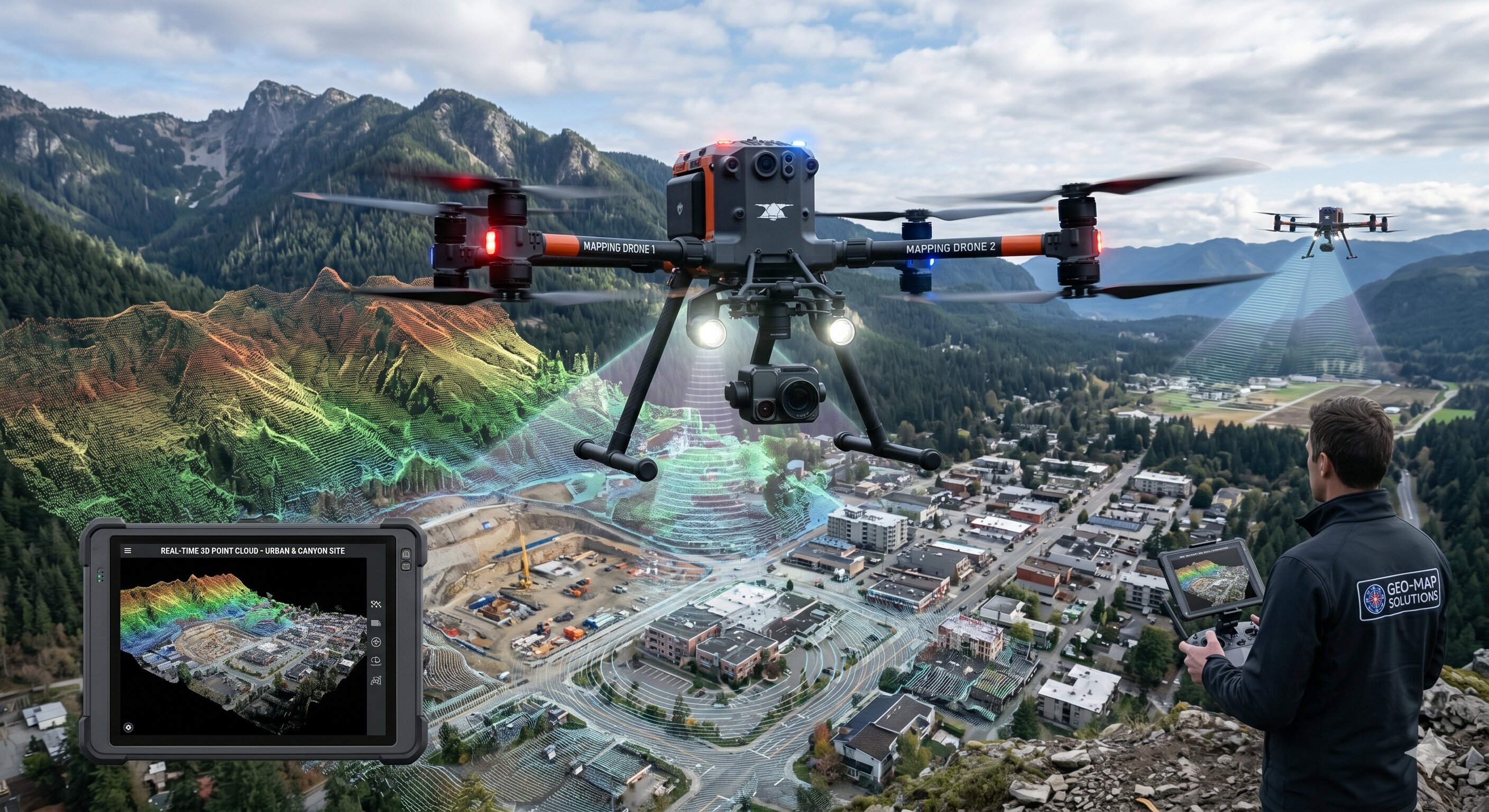
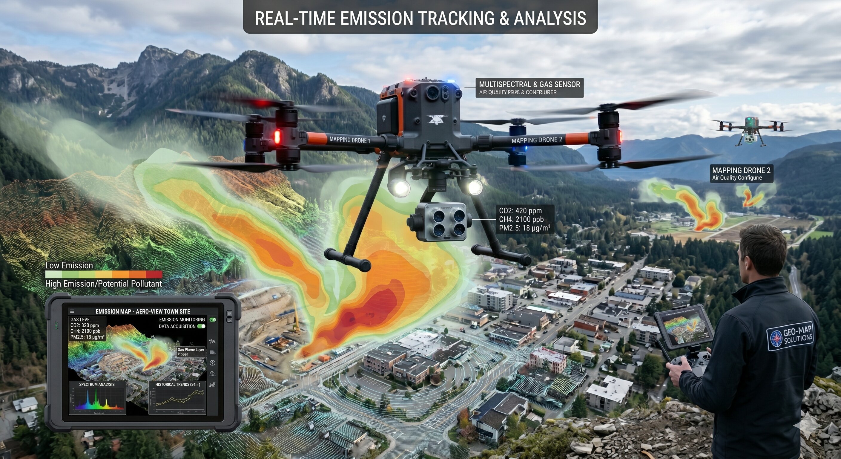
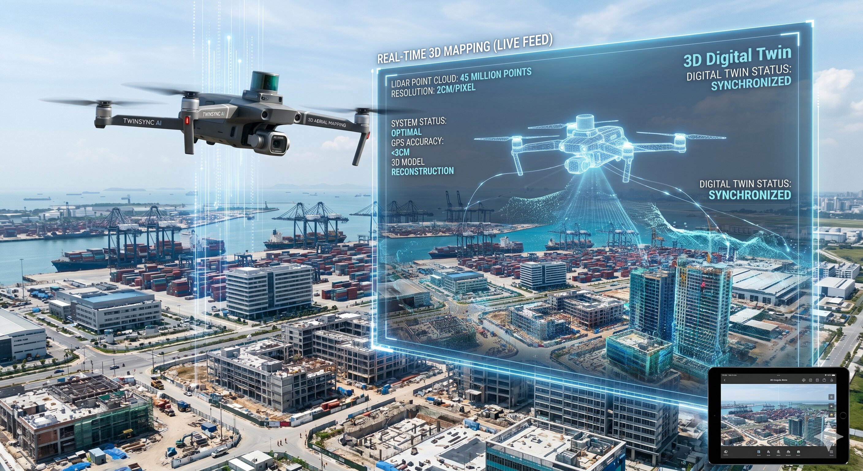
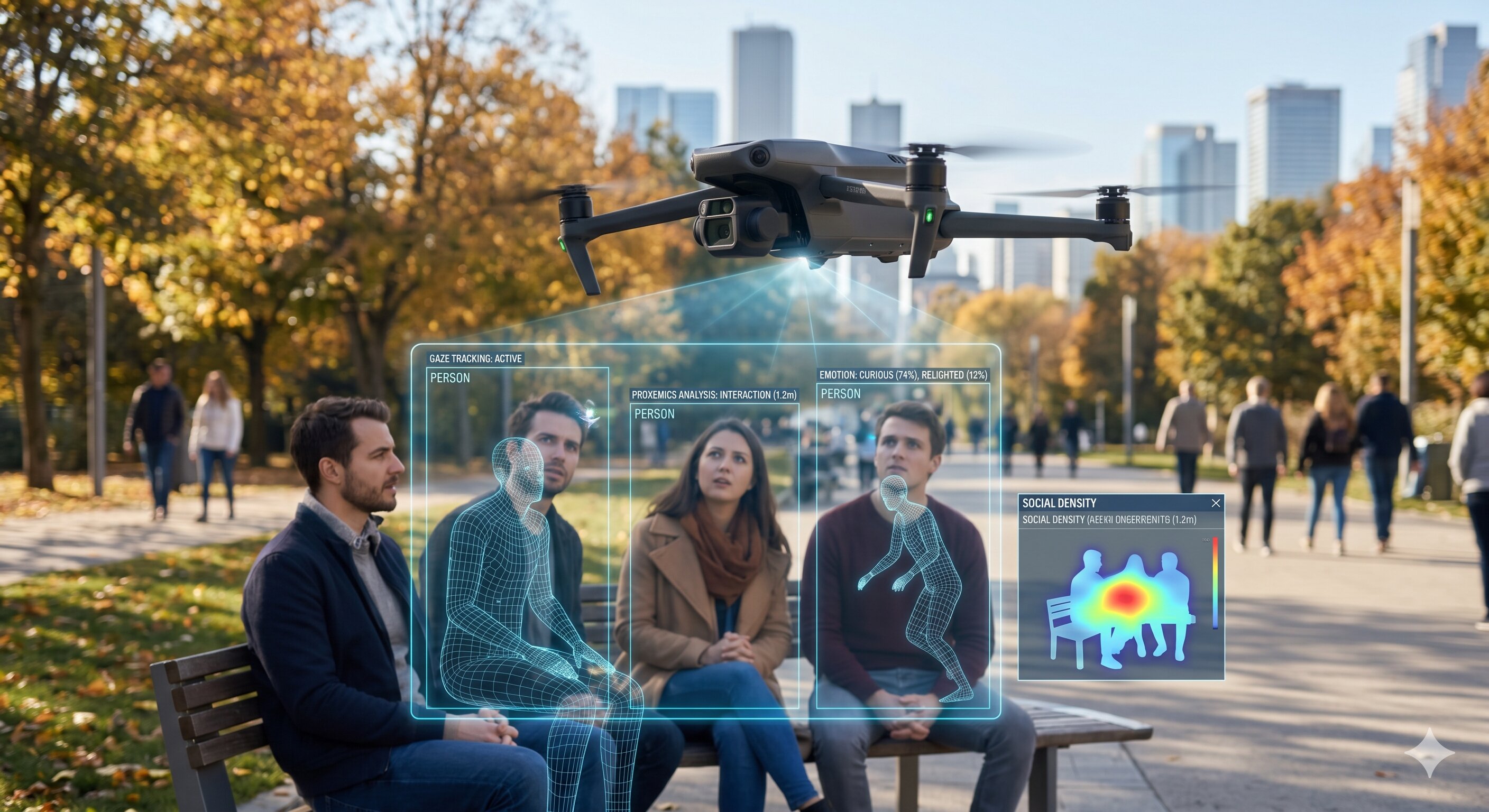
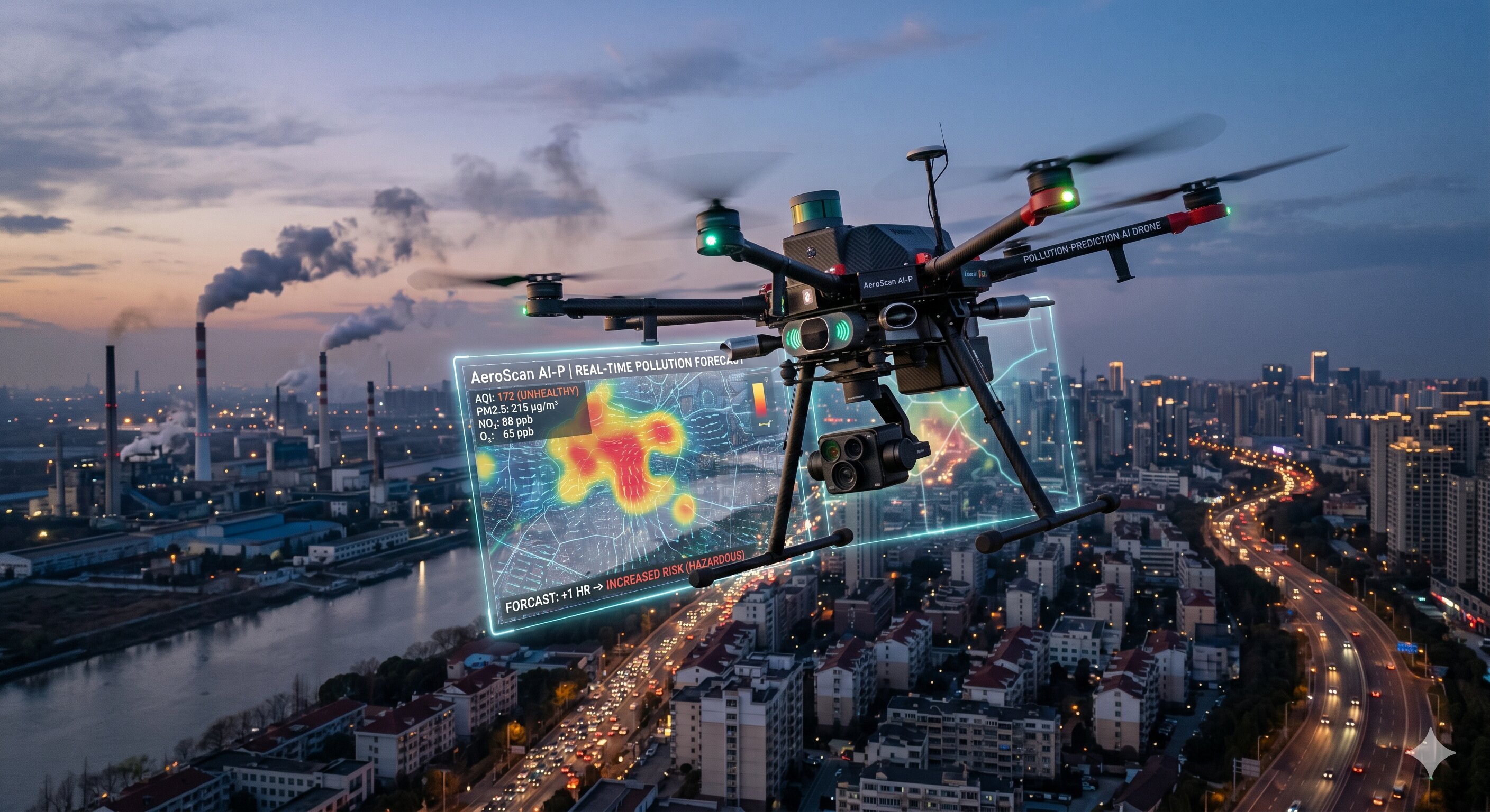
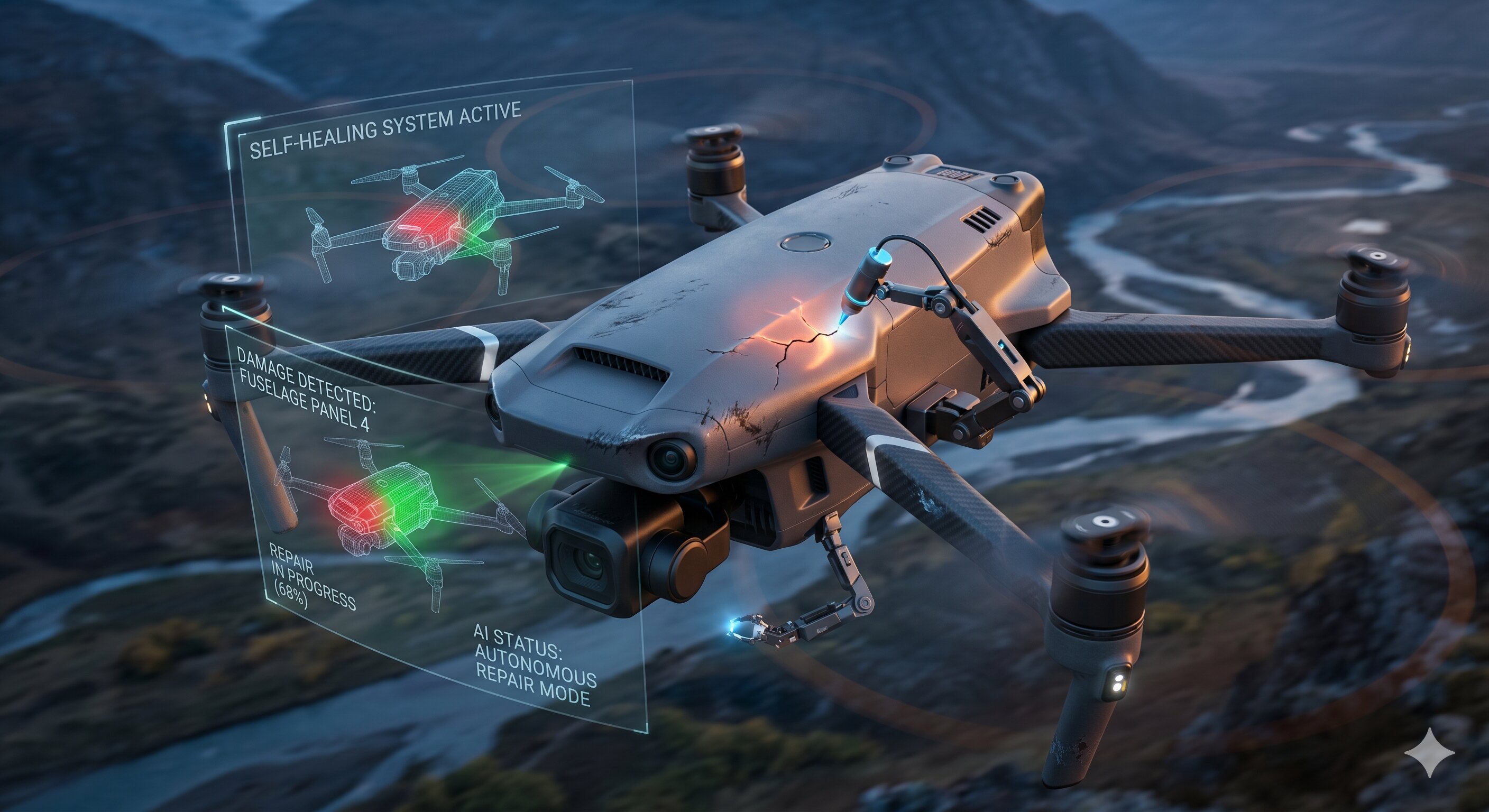
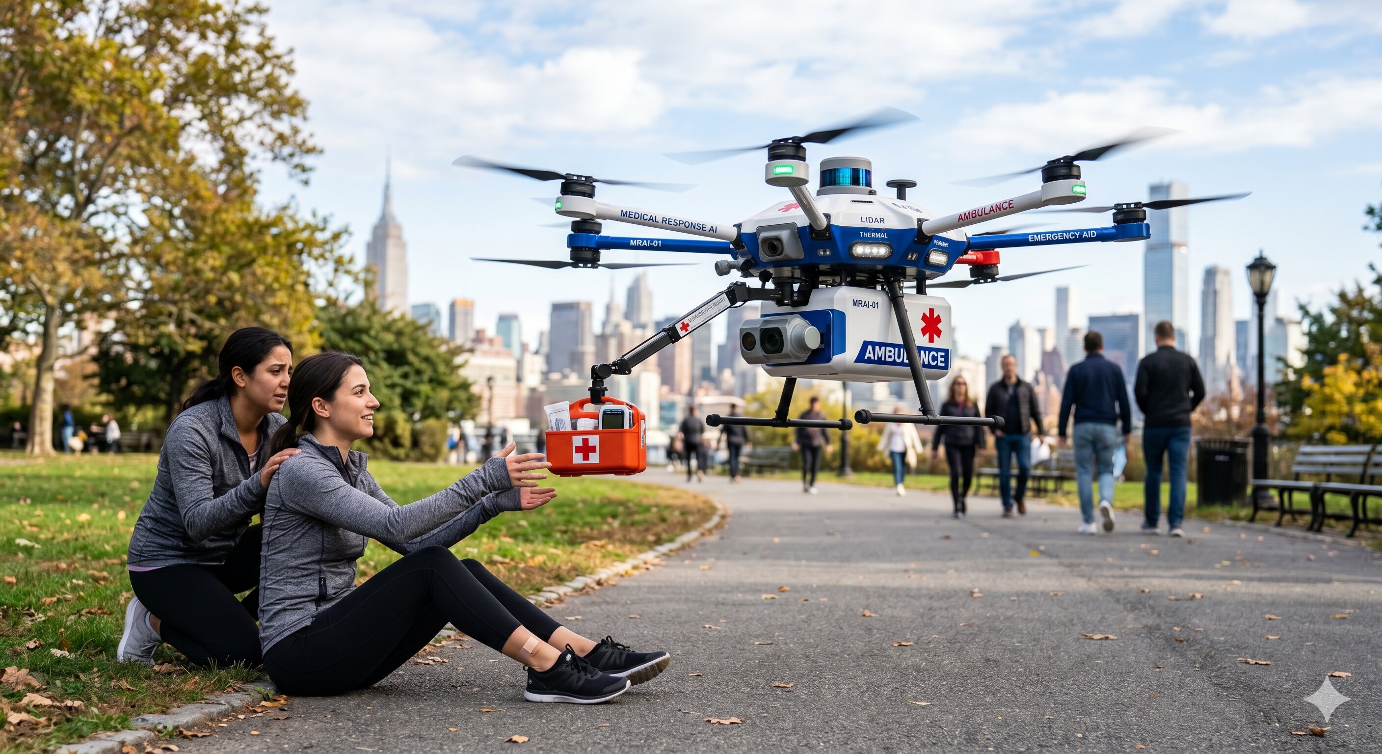
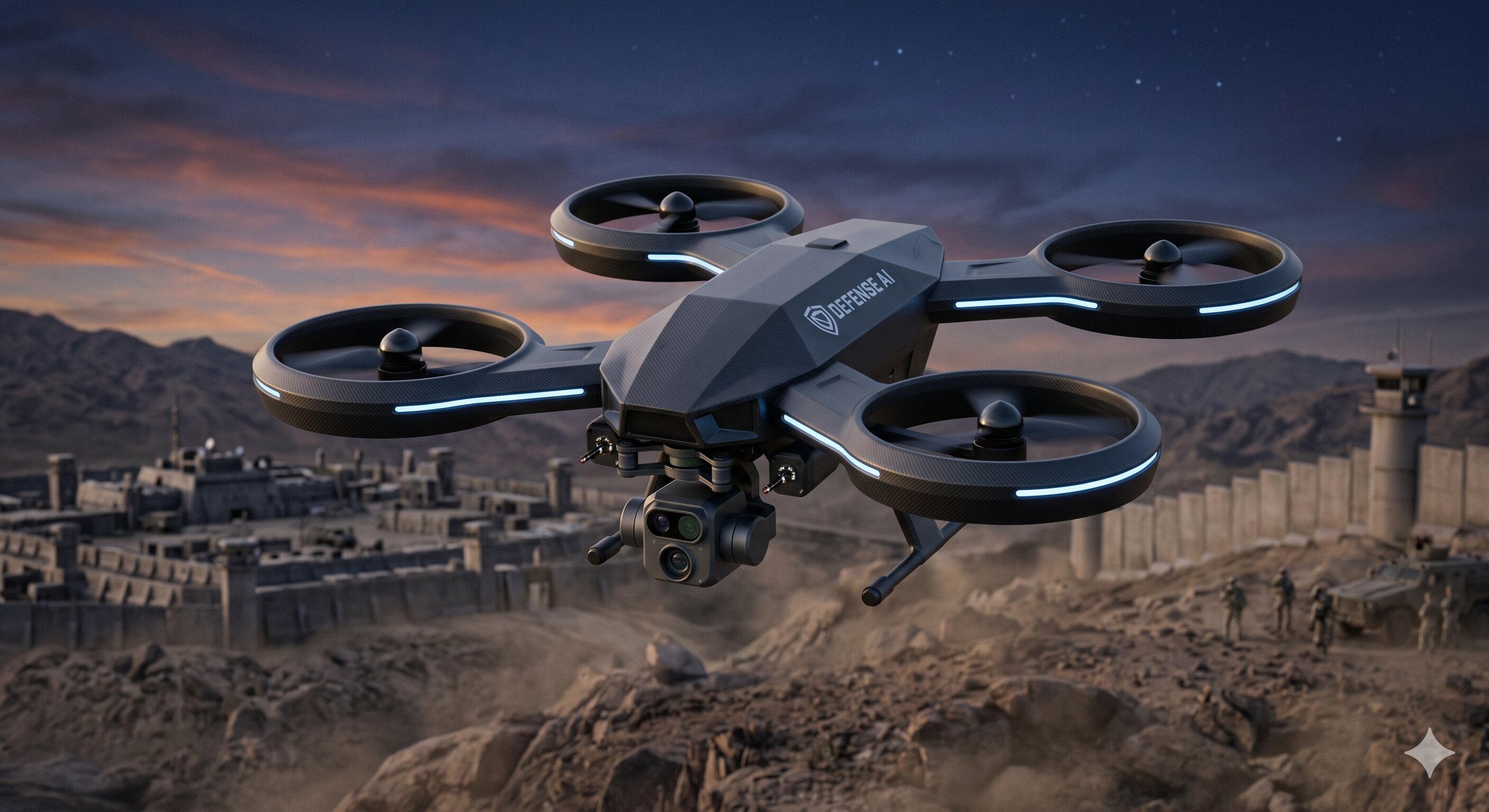
AlphaIndies is redefining environmental monitoring. By fusing Edge AI with IoT Sensing, we transform standard drones into intelligent data gatherers.

AI-Powered Drones

AI-Powered Drones

Real-time crop monitoring and Environmental Monitoring (Click to View Project)

Navigation Algorithm

Navigation Algorithm

SkyLord Eyes - The Intelligent Vision Algorithm

Our 8 Core Capabilities

Next-Gen Edge AI

Intelligent Drones.
Redefining the Skies.

Fusing high-performance Edge AI with advanced IoT sensing. Our autonomous drones analyze environments in real-time without relying on cloud connectivity.

Vision & Snapshot

Traditional drones are merely flying cameras, relying on post-flight analysis or heavy cloud computing. We are shifting the paradigm by bringing the "brain" directly to the edge.

Our AI-Powered Drones instantly detect anomalies, map terrain, and monitor crop health entirely on-board. This drastically reduces latency, enhances security, and allows for continuous operation in remote areas.

Drone engineering

Core Features

Engineered for absolute autonomy and precision.

Edge Processing

On-board neural networks process 4K video feeds in real-time without internet connectivity.

Swarm Coordination

Multiple drones communicate seamlessly to cover massive areas, self-organizing flight paths.

Obstacle Avoidance

LiDAR and stereo vision combine to create a 360-degree safety bubble around the aircraft.

System Architecture

The perfect synergy between hardware muscle and software intelligence.

Hardware Stack

  • NVIDIA Jetson Edge DevicesProviding server-level compute in a lightweight form factor.
  • Multispectral SensorsCapturing data beyond the human visual spectrum.
  • High-Torque Brushless MotorsEnsuring stability in high wind conditions up to 40km/h.

Software Stack

  • Custom Vision Models (PyTorch)Trained on massive proprietary datasets for object and anomaly detection.
  • ROS2 (Robot Operating System)The backbone for real-time sensor fusion and flight control.
  • SkyLord Navigation AlgorithmOur proprietary path planning system for GPS-denied environments.

Primary Applications

Agriculture

Precision Agri

Crop health and yield prediction.

Search and Rescue

Search & Rescue

Thermal human detection AI.

Mapping

3D Mapping

Digital twins of infrastructure.

Environment

Emissions Tracking

Air quality & pollution monitoring.

Behind the build

Our Team

A focused team of B.Tech students from AI & Data Science — combining hardware, AI, and cloud expertise.

Rahul Raveendran

Rahul Raveendran

Dashboard Engineer

Expert in data visualization and dashboard UX interfaces for mission control.

Avinash S

Avinash S

Cloud Engineer

Manages cloud infrastructure, database scalability, and secure API endpoints.

Ranjith V

Ranjith V

AI-System Integration Engineer

Leads the AI pipeline architecture and seamless integration of hardware, software, and cloud systems.

Proprietary Software

SkyLord Eyes.
Autonomous Navigation.

Breaking free from GPS reliance. Our intelligent vision algorithm empowers machines to understand, map, and traverse complex, unpredictable environments in real-time.

Digital Mapping

The Brain Behind the Machine

Operating in GPS-denied environments like dense forests, urban canyons, or indoor industrial facilities requires more than basic telemetry. It requires true spatial awareness.

SkyLord Eyes uses advanced Visual-Inertial Odometry (VIO) and continuous Simultaneous Localization and Mapping (SLAM). It essentially allows our drones to "see" the world like humans do, mapping their surroundings frame-by-frame and predicting dynamic obstacles before they become a threat.

Core Algorithm Capabilities

Transforming raw pixel data into actionable flight physics.

Semantic Segmentation

Instantly categorizes millions of pixels into 'sky', 'building', 'human', or 'tree' to understand context.

Continuous SLAM

Builds high-resolution 3D point clouds of unmapped territories while simultaneously determining its own location within it.

Predictive Pathing

Calculates thousands of potential flight trajectories per second to actively avoid moving obstacles.

<10ms
Inference Latency
60+
Frames Per Second
3cm
Position Accuracy
Zero
Cloud Dependency
01 / Intelligence

Multi-Drone Swarm.
Collaborative Intelligence.

Swarm

Decentralized Coordination

Our swarming logic allows fleets of autonomous drones to communicate locally. If one node drops, the rest of the swarm reorganizes instantly to ensure mission completion without relying on a central command tower.

Swarm Metrics

  • 10,000+ Nodes Scalability
  • P2P Encrypted Telemetry
  • Sub-millisecond Synchronization
02 / Analysis

Human Behaviour AI.
Real-time Anomaly Detection.

Human Behavior AI

Predictive Threat Assessment

Using advanced kinematic skeletal tracking and edge-processed neural networks, our systems can detect distress signals, unauthorized access, or erratic crowd movements entirely from aerial feeds.

AI Metrics

  • 4K Skeletal Tracking
  • Sub-second Threat Identification
  • Thermal Signature Matching
03 / Hardware

Self-Healing System.
Unstoppable Operations.

Self Healing

Dynamic Redundancy

Hardware failure shouldn't mean mission failure. Our flight controllers use dynamic circuitry rerouting. If a motor drops efficiency or a sensor fails, the AI instantly compensates using secondary modules to guarantee a safe return.

Hardware Reliability

  • Triple-Redundant Sensors
  • Automated Auto-Charging Pads
  • In-flight Diagnostic Logic
04 / Environment

Pollution Prediction.
Hyper-Local AQI Modeling.

Pollution

Gas & Particulate Tracking

We equip our drones with industrial-grade olfactory sensors. By flying grid patterns over urban or industrial zones, we generate 3D heatmaps of CO2, Methane, and PM2.5 levels to predict emission spreads before they hit residential areas.

Sensing Capabilities

  • Multi-gas Olfactory Array
  • Predictive Wind Spread Modeling
  • Real-time Emission Alerts
05 / Mapping

3D Digital Twin.
Virtualizing Reality.

Digital Twin

High-Fidelity Photogrammetry

We capture millions of data points to generate millimeter-accurate, interactive 3D models of construction sites, heritage monuments, and industrial plants. Inspect infrastructure without ever setting foot on site.

Mapping Specs

  • LiDAR Point Cloud Generation
  • Centimeter-Level Precision
  • Automated Structural Defect AI
06 / Agriculture

Predictive Smart Farming.
Data-Driven Yields.

Smart Farming

Multispectral Crop Analysis

Spot crop disease and hydration issues weeks before they are visible to the human eye. We process NDVI (Normalized Difference Vegetation Index) data directly on the drone to immediately notify farmers of problem zones.

Agri-Metrics

  • On-board NDVI Processing
  • Targeted Pesticide Spraying
  • Soil Moisture Heatmaps
07 / Emergency

Medical Response.
Lifesaving Logistics.

Medical Response

Rapid Aerial Deployment

In critical moments, traffic and impassable terrain cost lives. Our high-speed delivery drones transport defibrillators, antivenoms, and emergency blood supplies directly to coordinates over zero-infrastructure paths.

Logistics Features

  • Temperature-Controlled Payload
  • Winch-Drop Mechanics
  • Priority Highway Corridors
08 / Defense

Tactical Recon.
Silent Observation.

Tactical Recon

Encrypted Intelligence Gathering

Designed for low acoustic signatures and high endurance, our recon units provide military and security forces with encrypted, jam-resistant live feeds. Thermal imaging ensures zero visibility drops during night ops.

Defense Specs

  • AES-256 Encrypted Telemetry
  • FLIR Thermal Imaging
  • Anti-Jamming Frequency Hopping
About Us

Building the Future of
Autonomous Robotics.

We are a deep-tech company engineering the perfect synergy between advanced hardware, edge AI, and scalable cloud infrastructure.

Our Mission

Empowering Industries with Intelligent Edge AI

At AlphaIndies, we believe the future of industrial automation and environmental monitoring lies at the edge. Our mission is to eliminate the reliance on cloud infrastructure for critical robotic decision-making.

  • Real-time autonomy without internet connectivity.
  • Scalable, swarm-based mapping operations.
  • Cost-effective hardware integrations for all terrains.
Company Mission
Company Story

Our Story

From a College Lab to Deep-Tech Innovation

What started as an ambitious project by a group of passionate B.Tech students in AI & Data Science quickly evolved into a fully-fledged vision for the future of commercial robotics.

By combining our complementary skills in hardware engineering, computer vision, and cloud architecture, we developed our proprietary SkyLord Navigation Algorithm. Today, we are building drones capable of true localized thought to solve real-world problems in agriculture, defense, and environmental tracking.

Behind the build

Our Team

Rahul Raveendran

Rahul Raveendran

Dashboard Engineer

Expert in data visualization and dashboard UX interfaces for mission control.

Avinash S

Avinash S

Cloud Engineer

Manages cloud infrastructure, database scalability, and secure API endpoints.

Ranjith V

Ranjith V

AI-System Integration Engineer

Leads the AI pipeline architecture and seamless integration of hardware, software, and cloud systems.